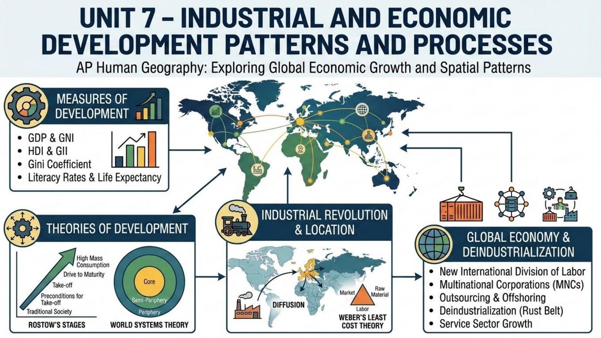
1
Unit 1
Thinking Geographically
Foundational concepts · approx. 8–10% of exam
🎙
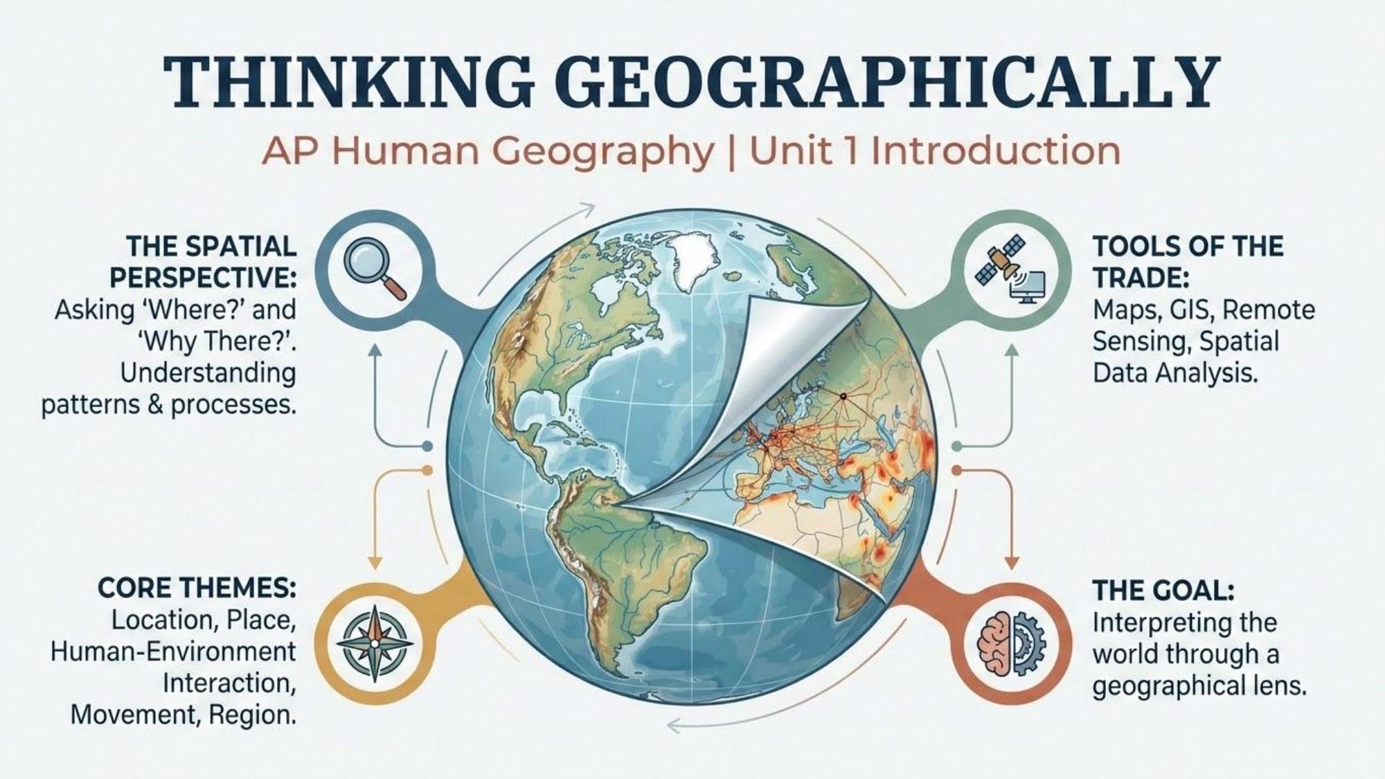
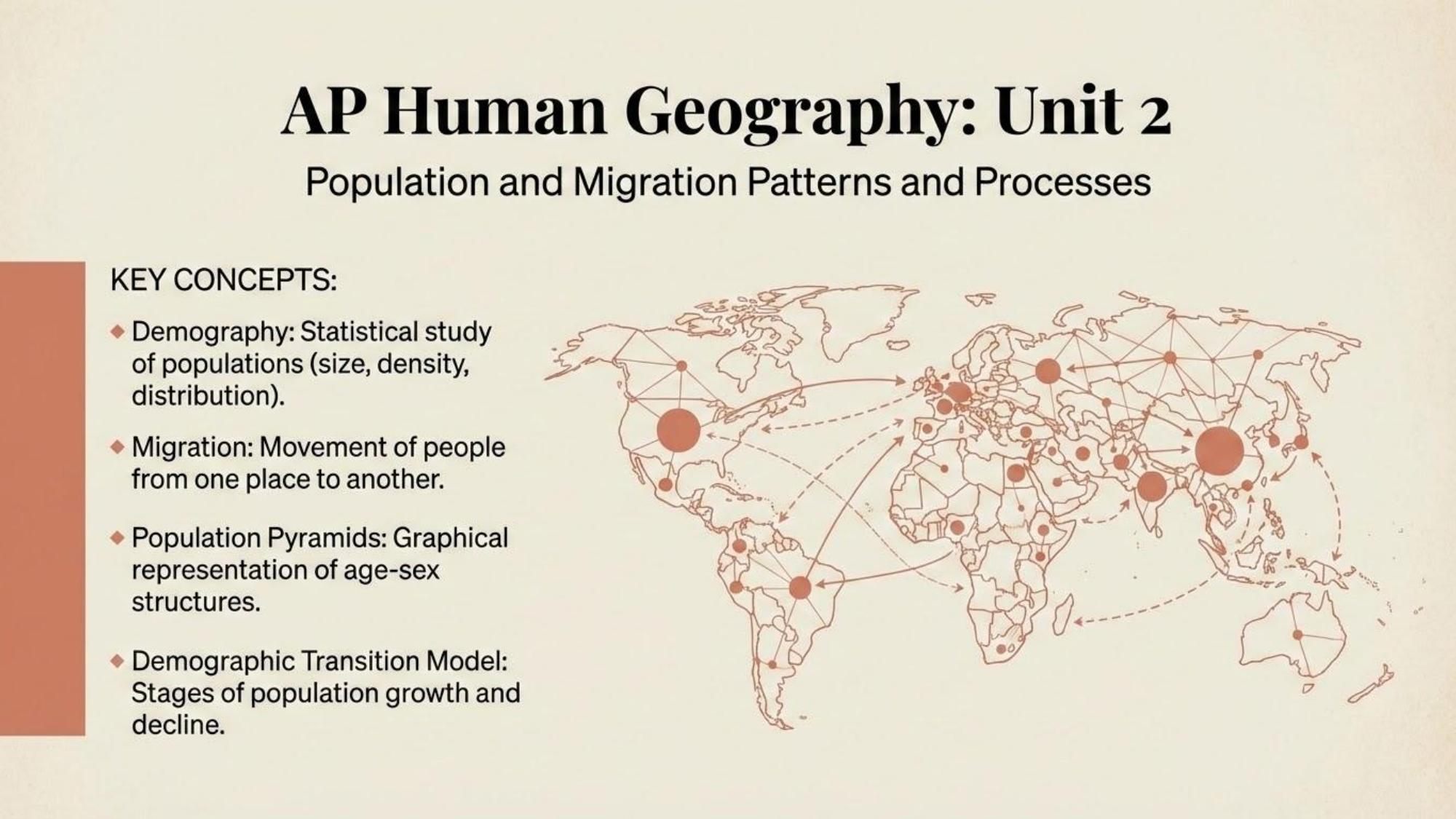
Unit 1: Thinking Geographically
Maps, geographic data, spatial patterns, and the tools geographers use to analyze the world.
🎙 Episode 1 · 23:47
0:0023:47
Question
What is the difference between absolute and relative location?
Unit 1 · Thinking Geographically
tap to flip
Answer
Absolute location gives an exact position using coordinates (latitude/longitude). Relative location describes a place in relation to other places (e.g., "north of the river").
Card 1 of 12
Question 1 of 5
Score: 0/5
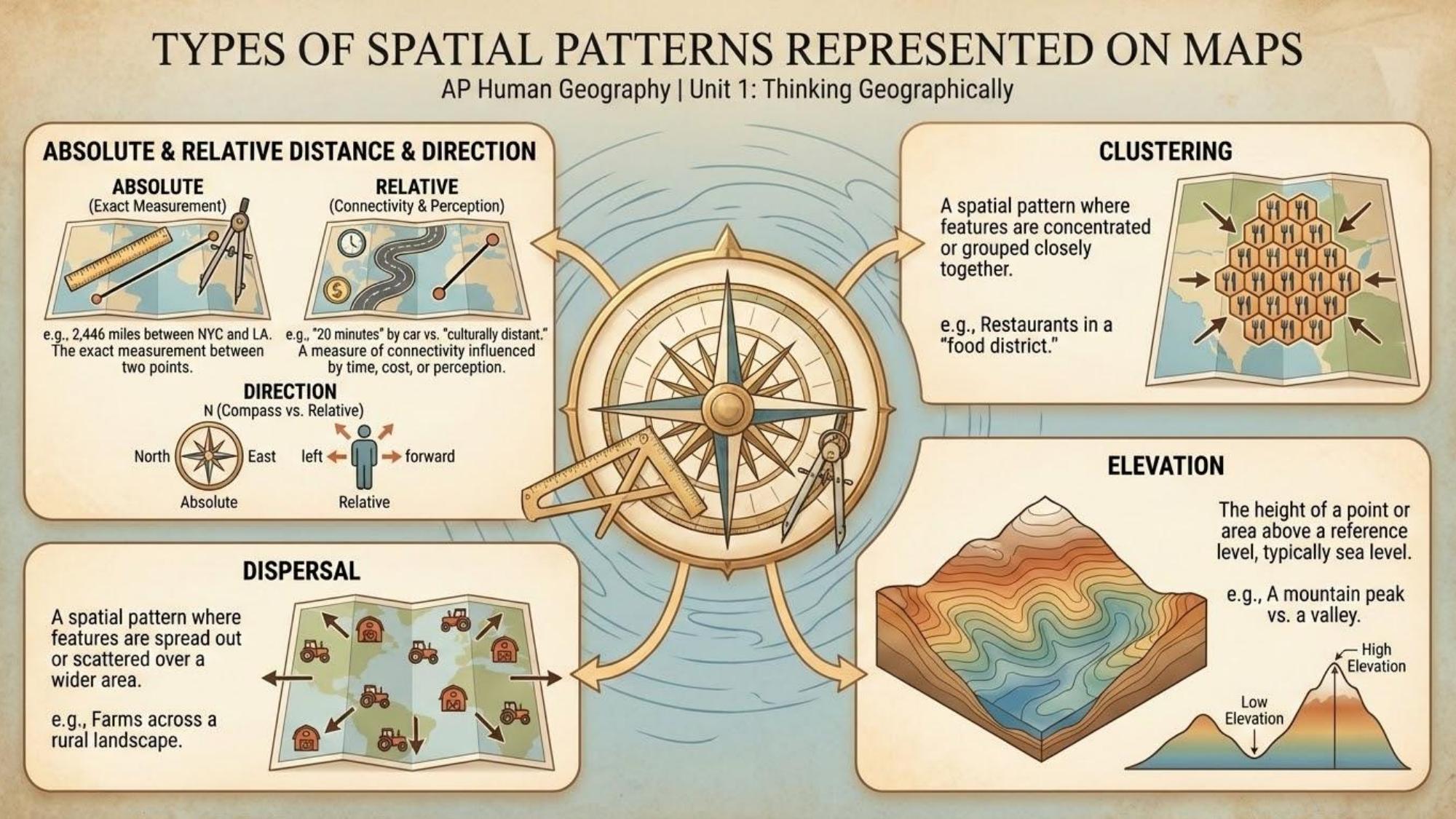
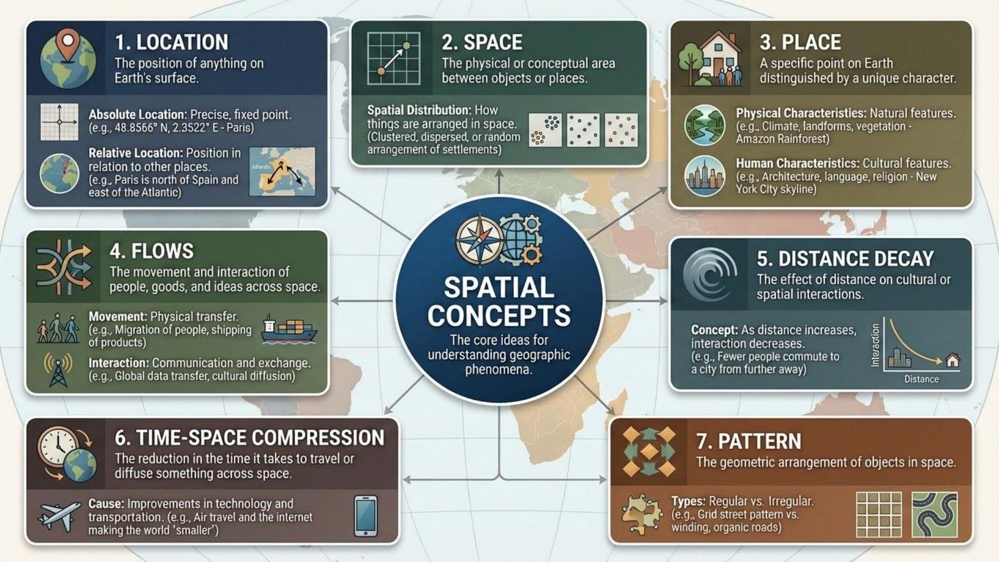
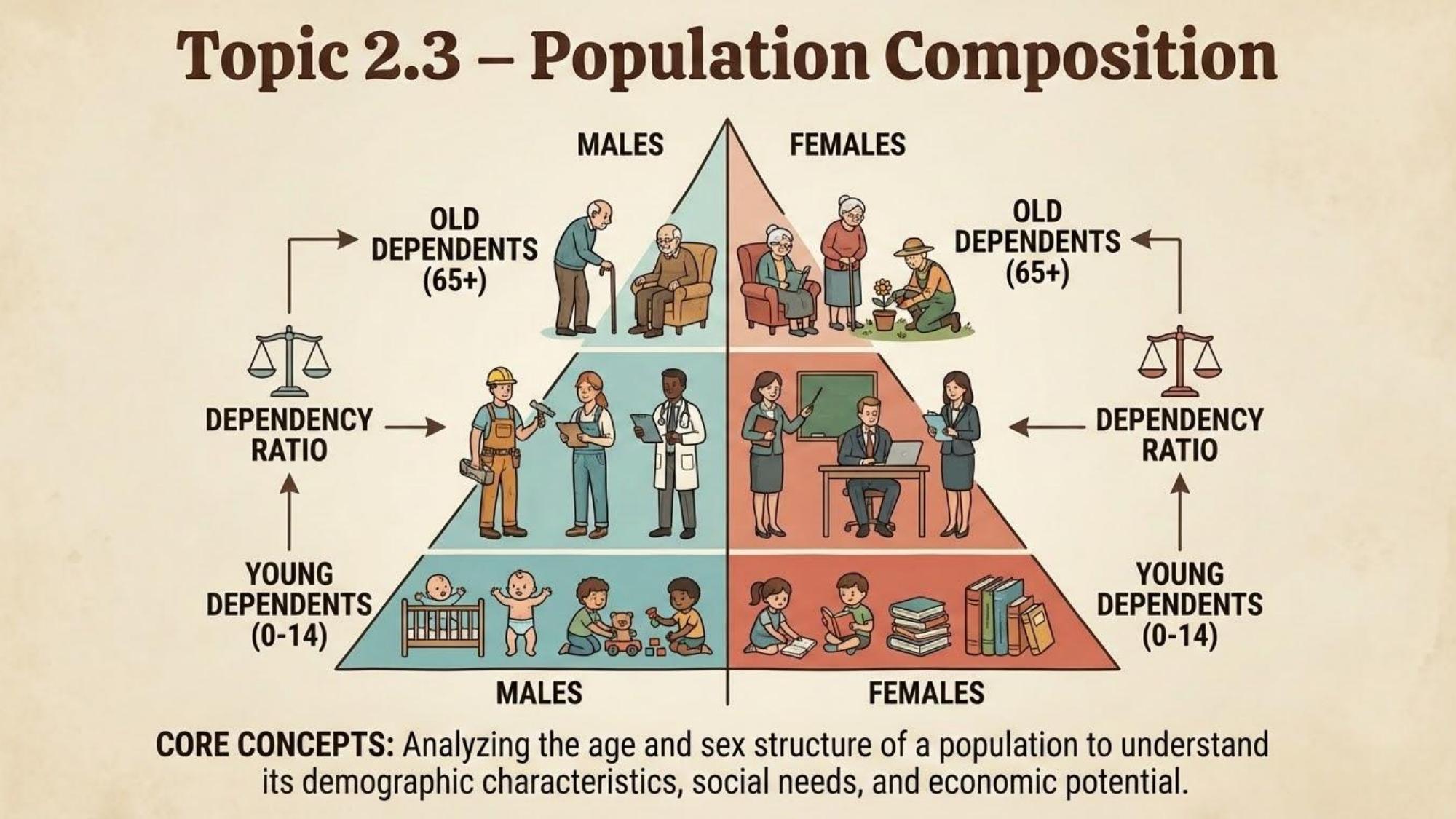
Absolute Location
Exact position on Earth using a coordinate system such as latitude and longitude.
Geographic ConceptsRelative Location
Position of a place in relation to other places or features.
Geographic ConceptsSense of Place
Subjective feelings and emotional attachments people have toward a location.
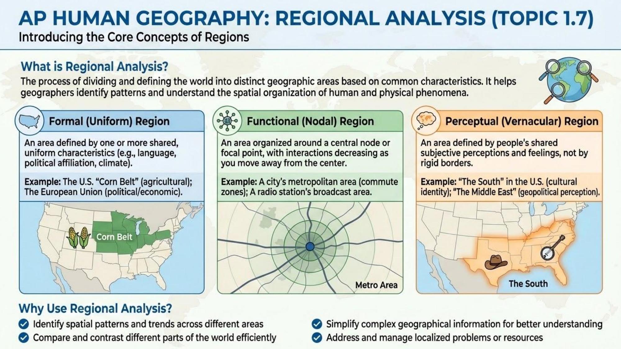
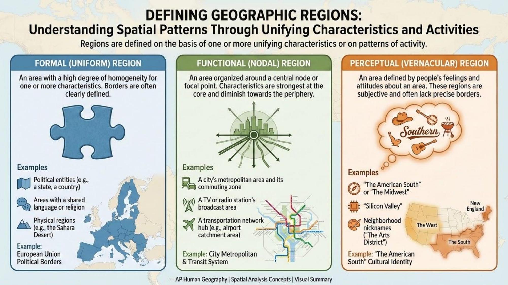
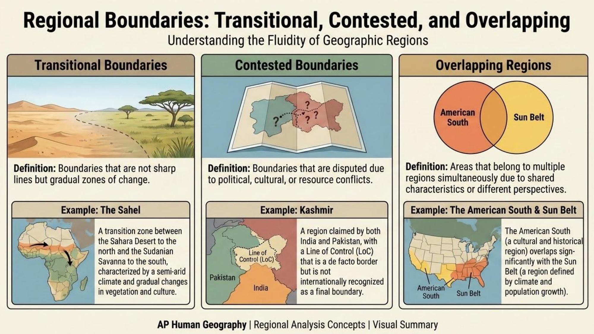
Place & SpaceRegion
Area sharing one or more common characteristics — formal, functional, or vernacular.
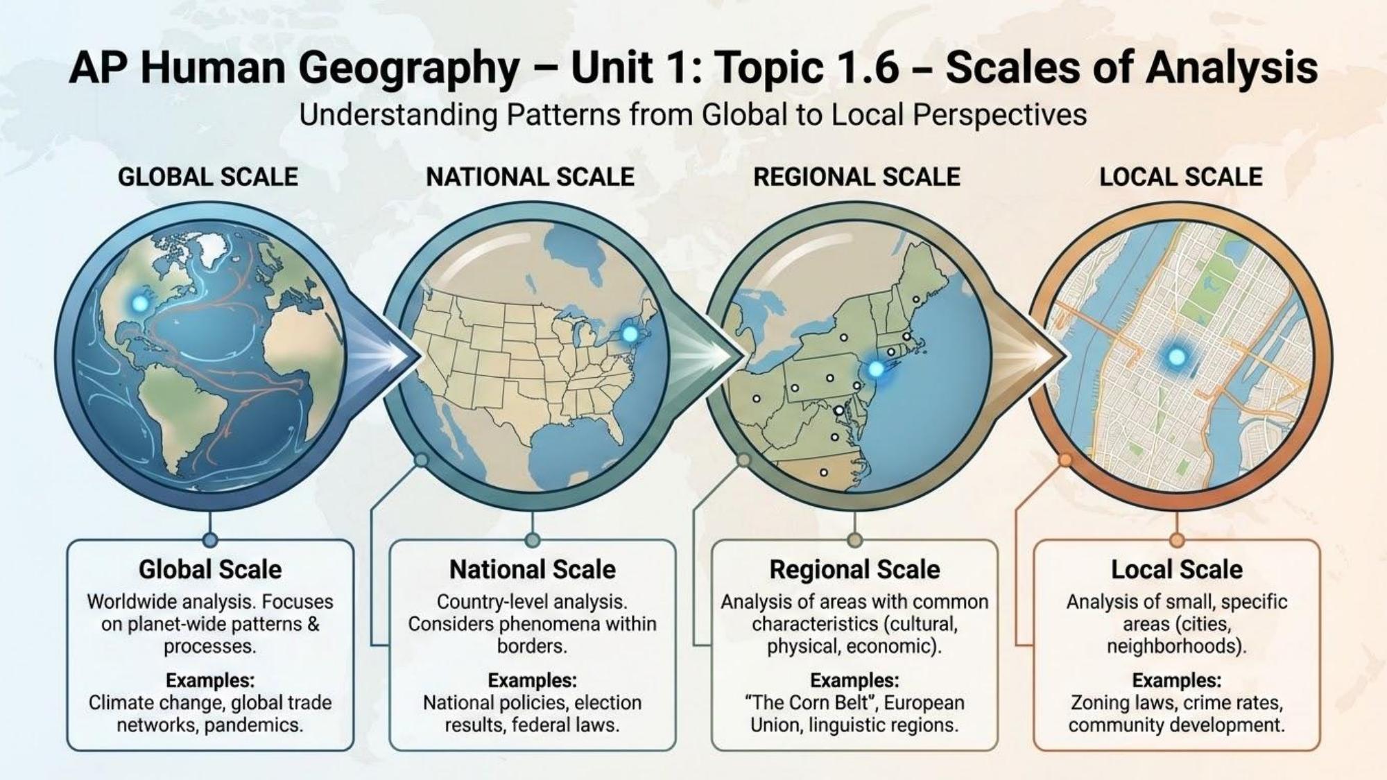
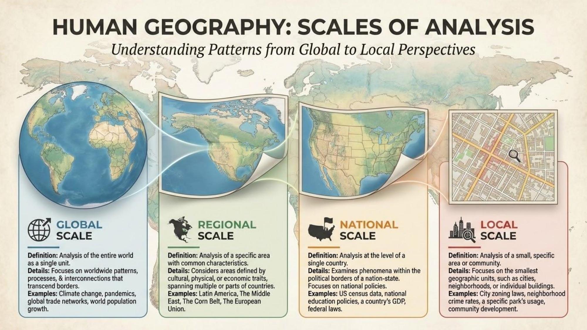
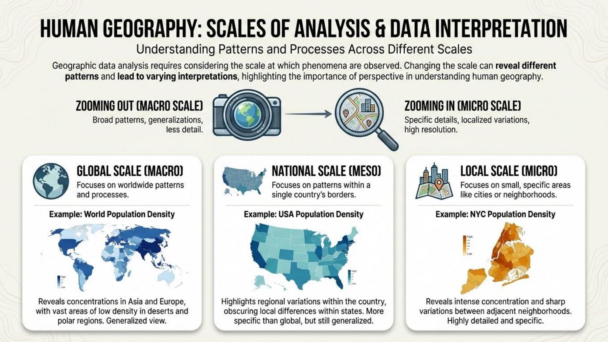
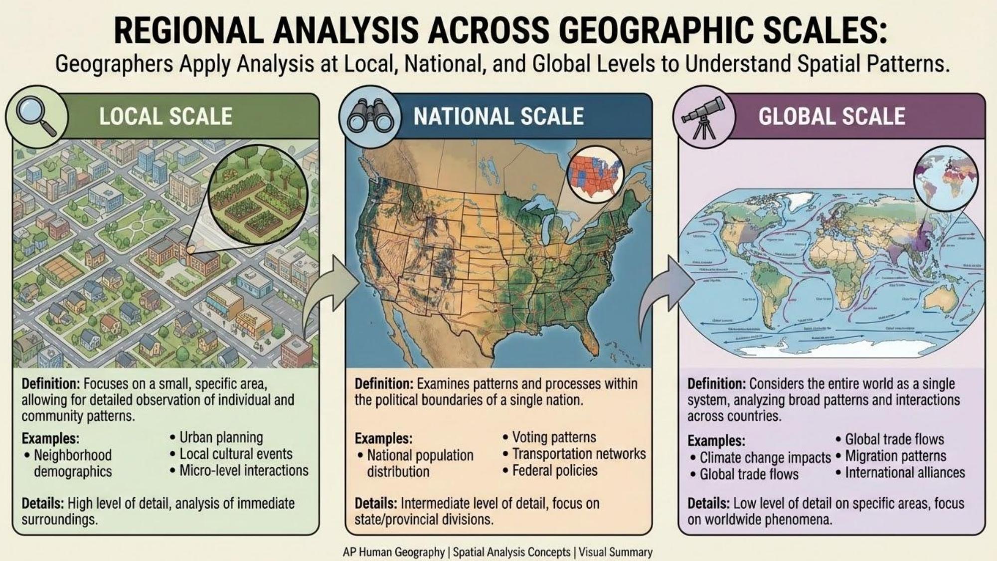
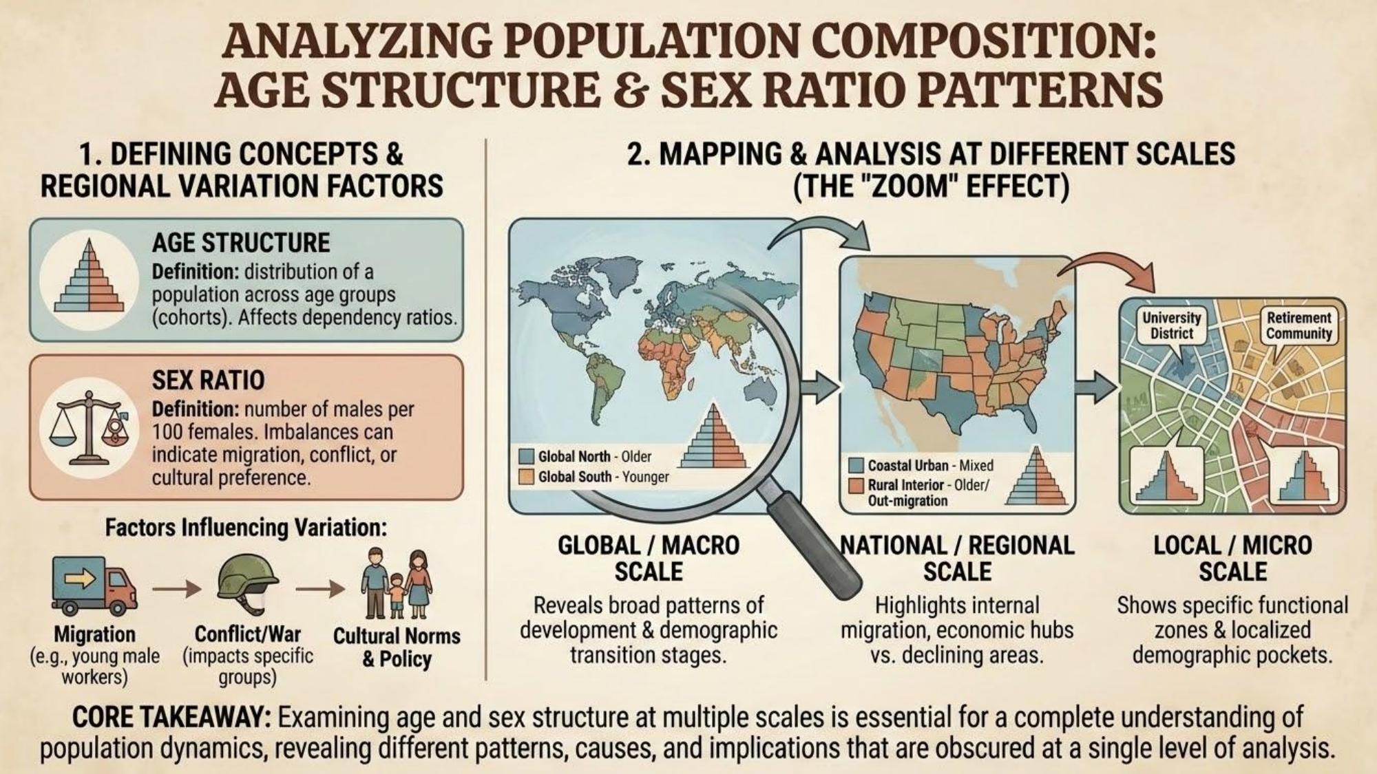
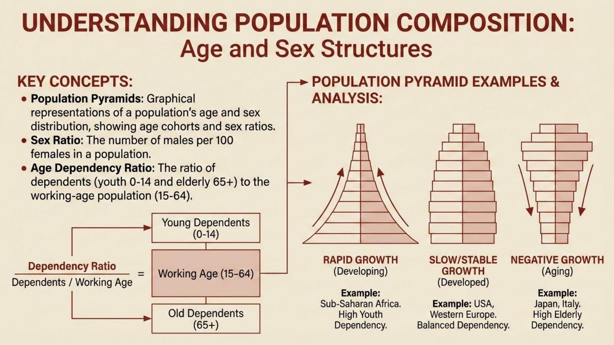
Geographic ConceptsScale of Analysis
The level (local, national, global) at which geographic phenomena are examined.
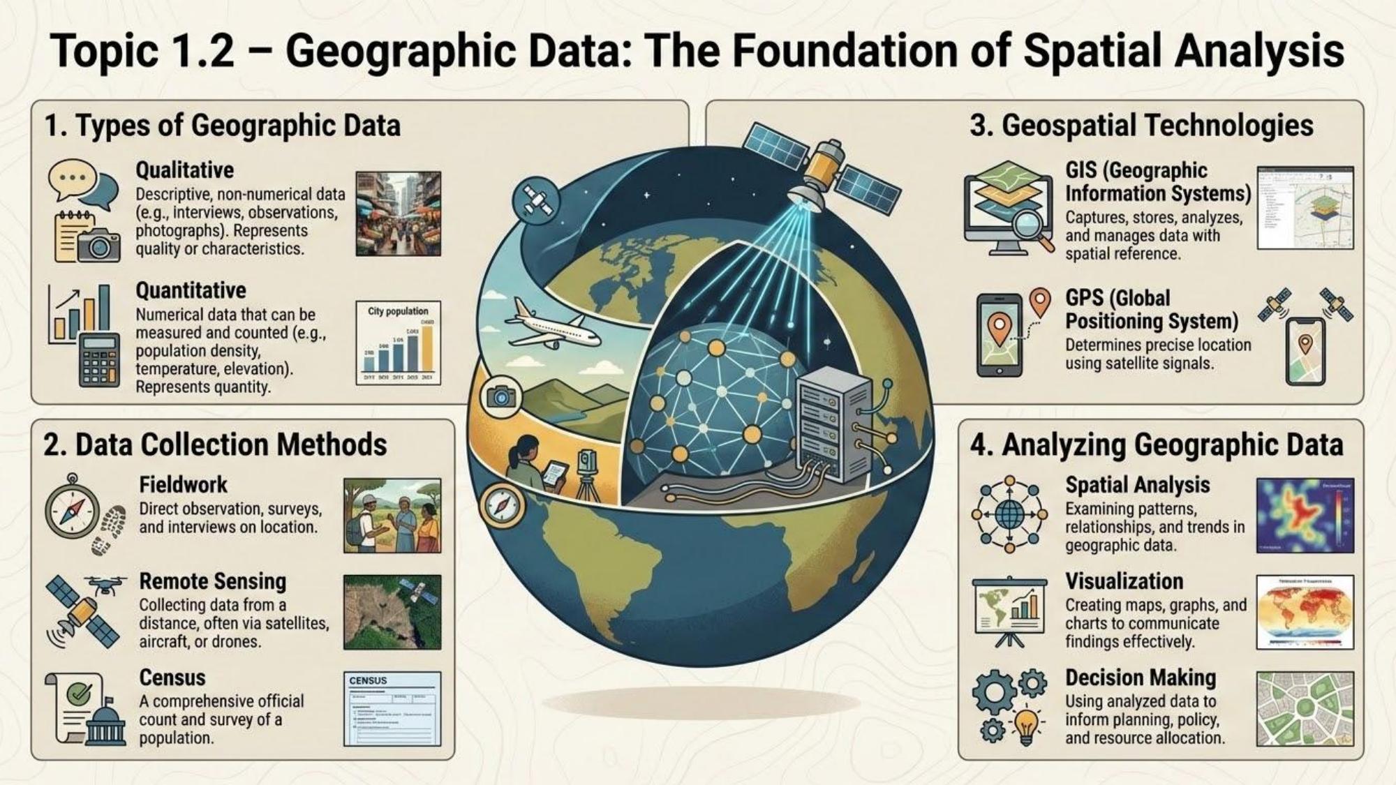
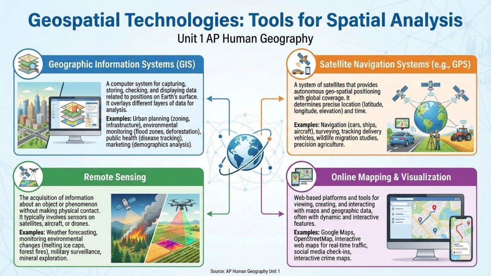
Geographic ToolsGIS (Geographic Information System)
Computer system for storing, analyzing, and displaying geographic data in layered maps.
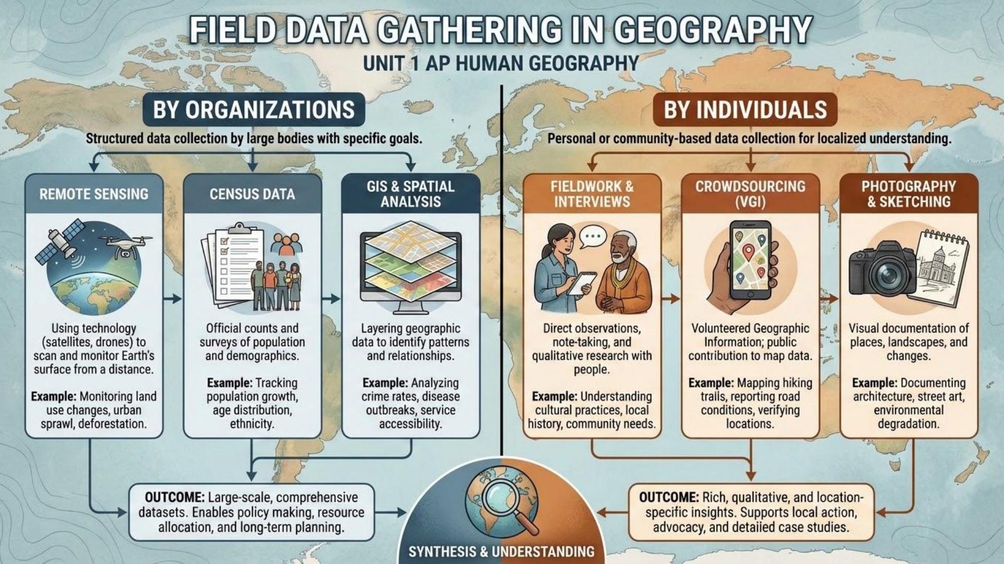
Geographic ToolsRemote Sensing
Collecting data about Earth's surface from satellites or aircraft without direct contact.
Geographic ToolsGPS (Global Positioning System)
Satellite-based navigation system that provides precise location data.
Geographic ToolsSpatial Distribution
The arrangement of phenomena across Earth's surface; described by density, concentration, and pattern.
Spatial ConceptsDistance Decay
The decrease in interaction between two places as the distance between them increases.
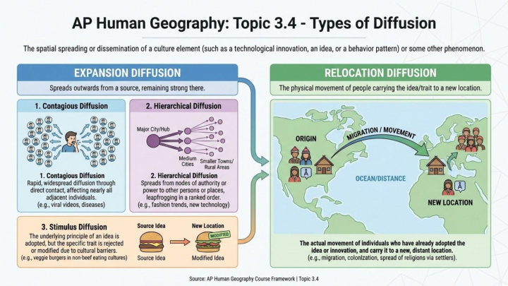
Spatial ConceptsDiffusion
The spread of an idea, innovation, or cultural practice from its origin to other locations.
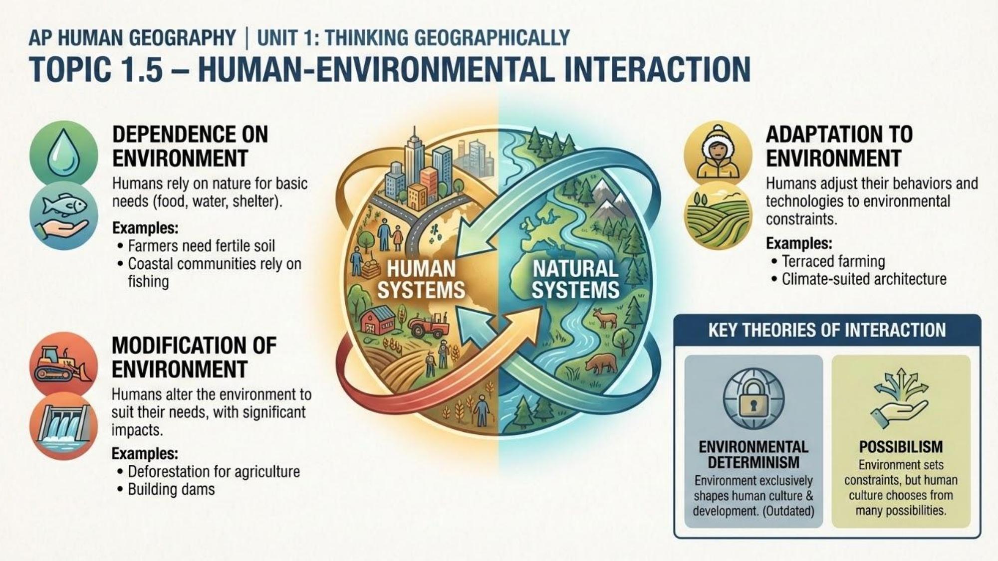
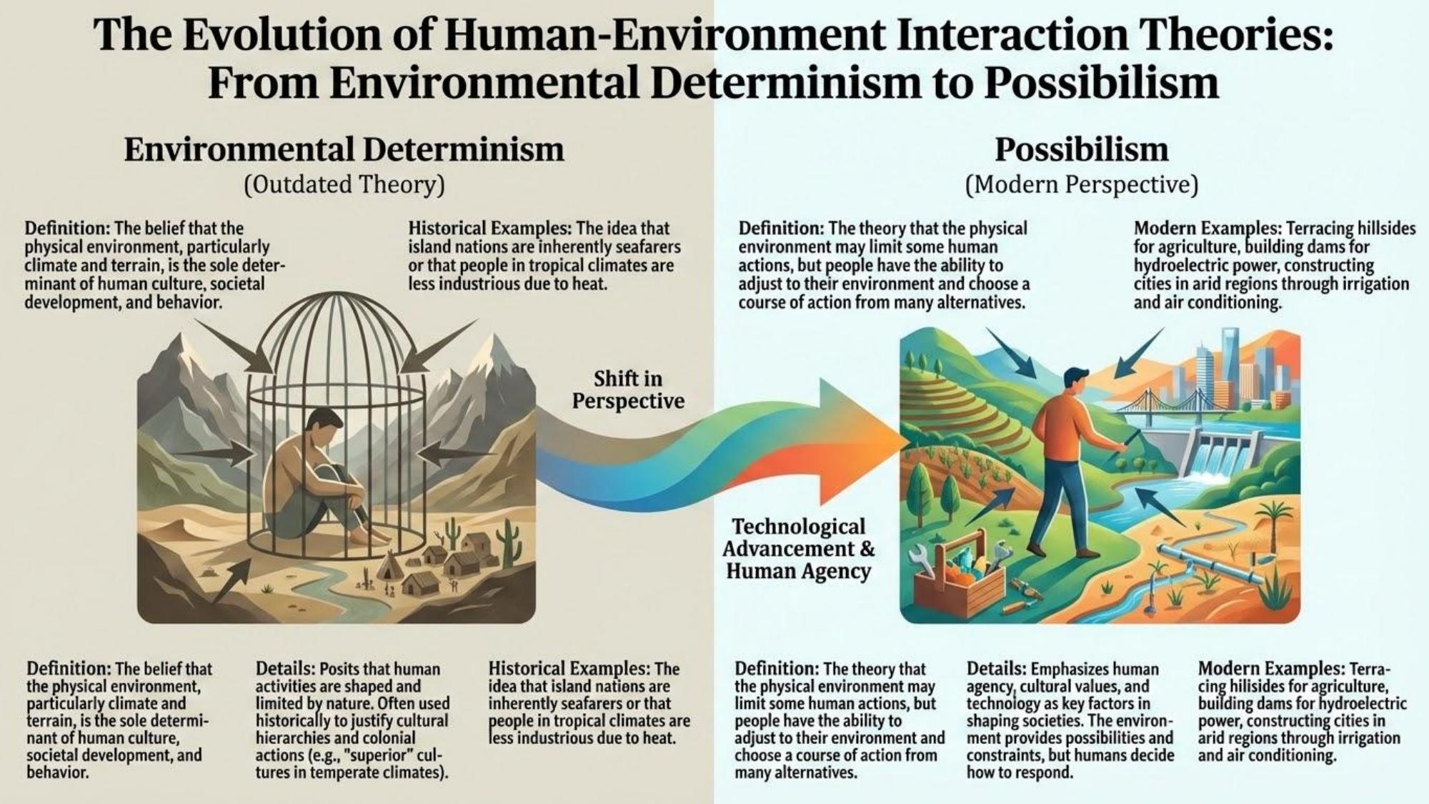
Spatial ConceptsEnvironmental Determinism
Discredited theory that the physical environment controls human behavior and development.
TheoriesPossibilism
Theory that the environment limits but does not determine human action — humans adapt and choose.
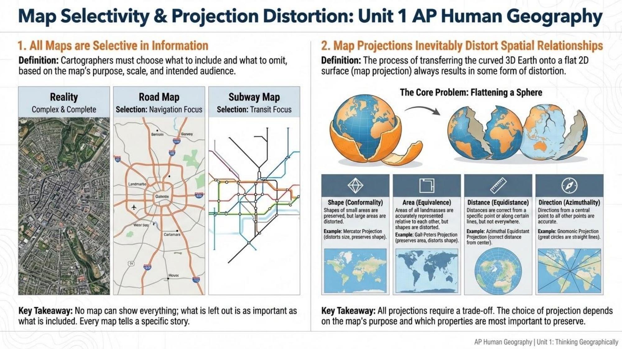
TheoriesCartogram
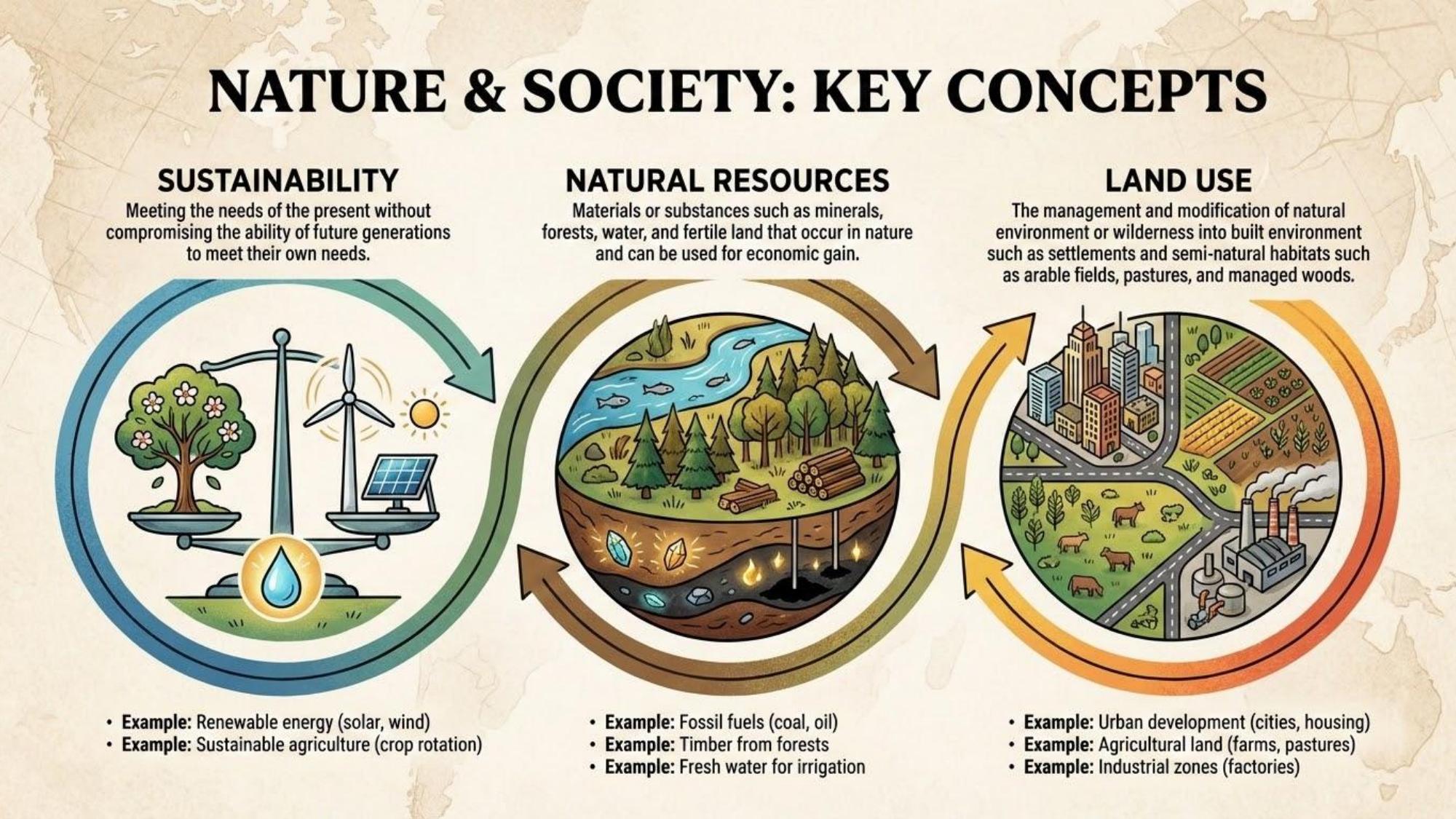
Map that distorts geographic area proportionally to a variable such as population or GDP.
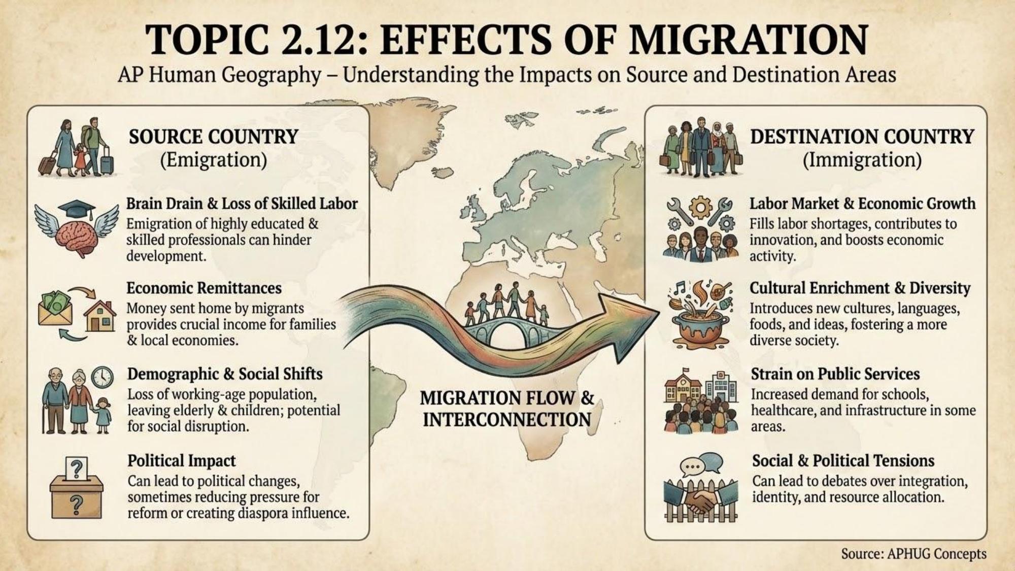
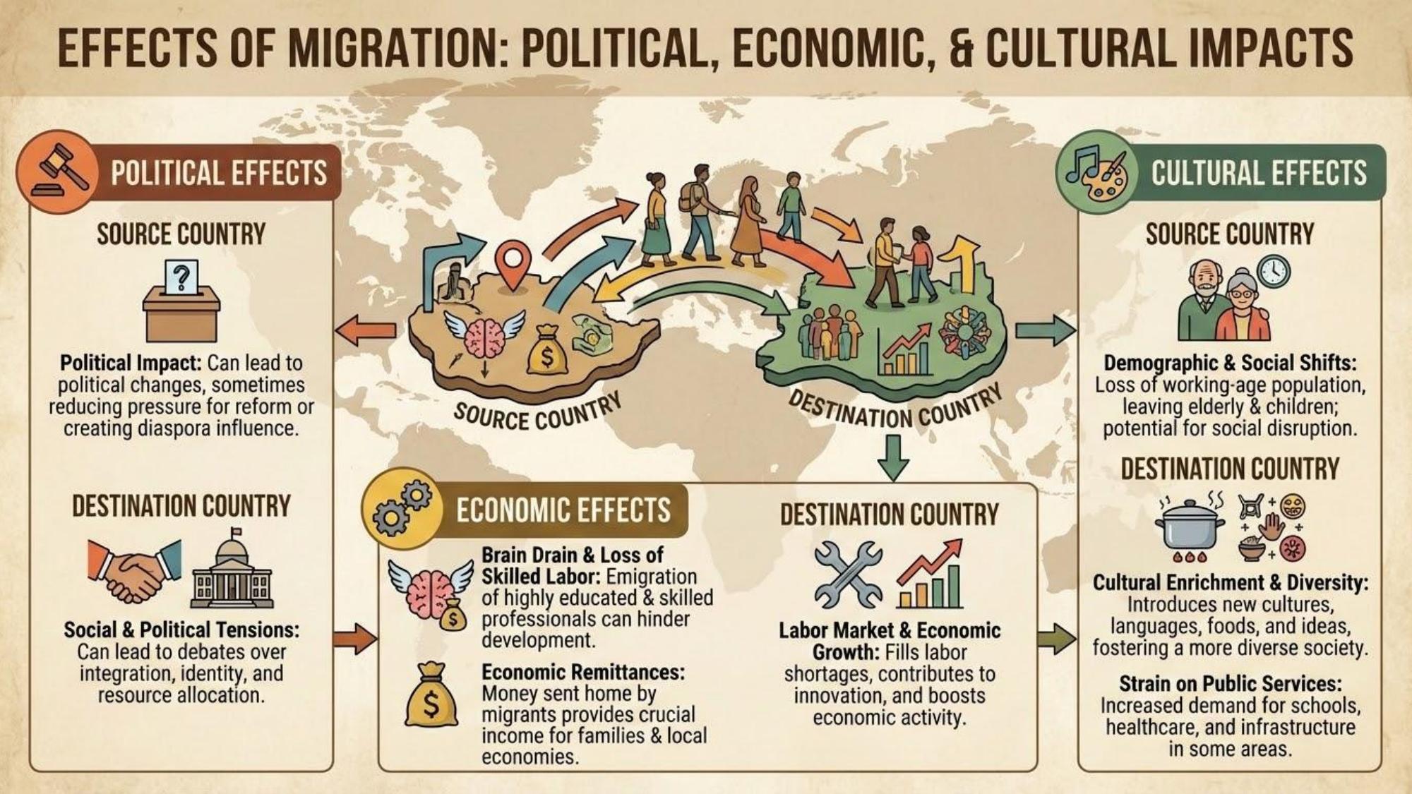
Geographic ToolsBig Idea 1
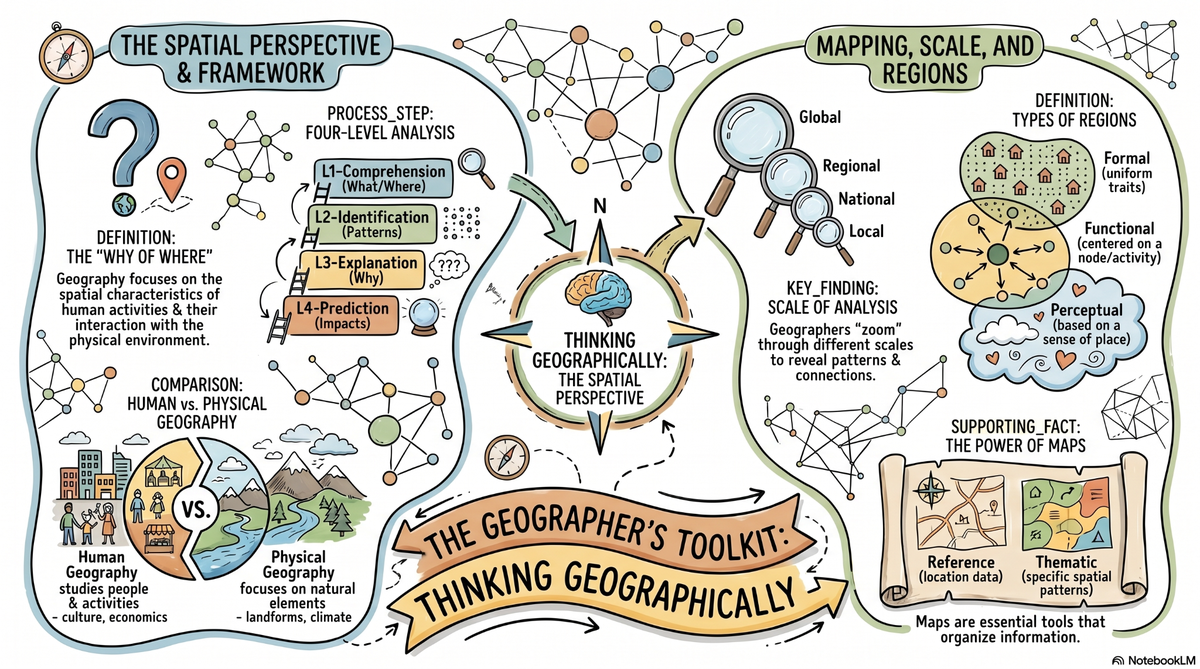
Geographers study where things are and why they are there
Geography is fundamentally about spatial thinking — understanding why phenomena are located where they are, how they are distributed, and how location affects human and physical systems. Every AP Human Geography question ultimately asks you to think spatially.
Big Idea 2
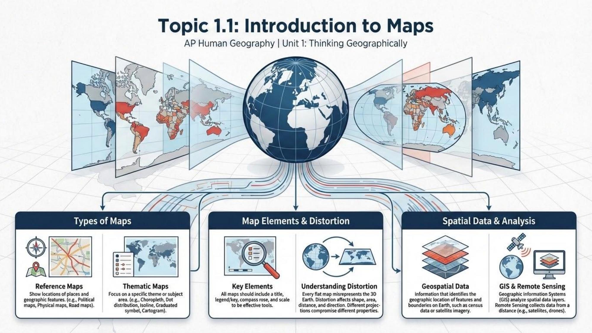
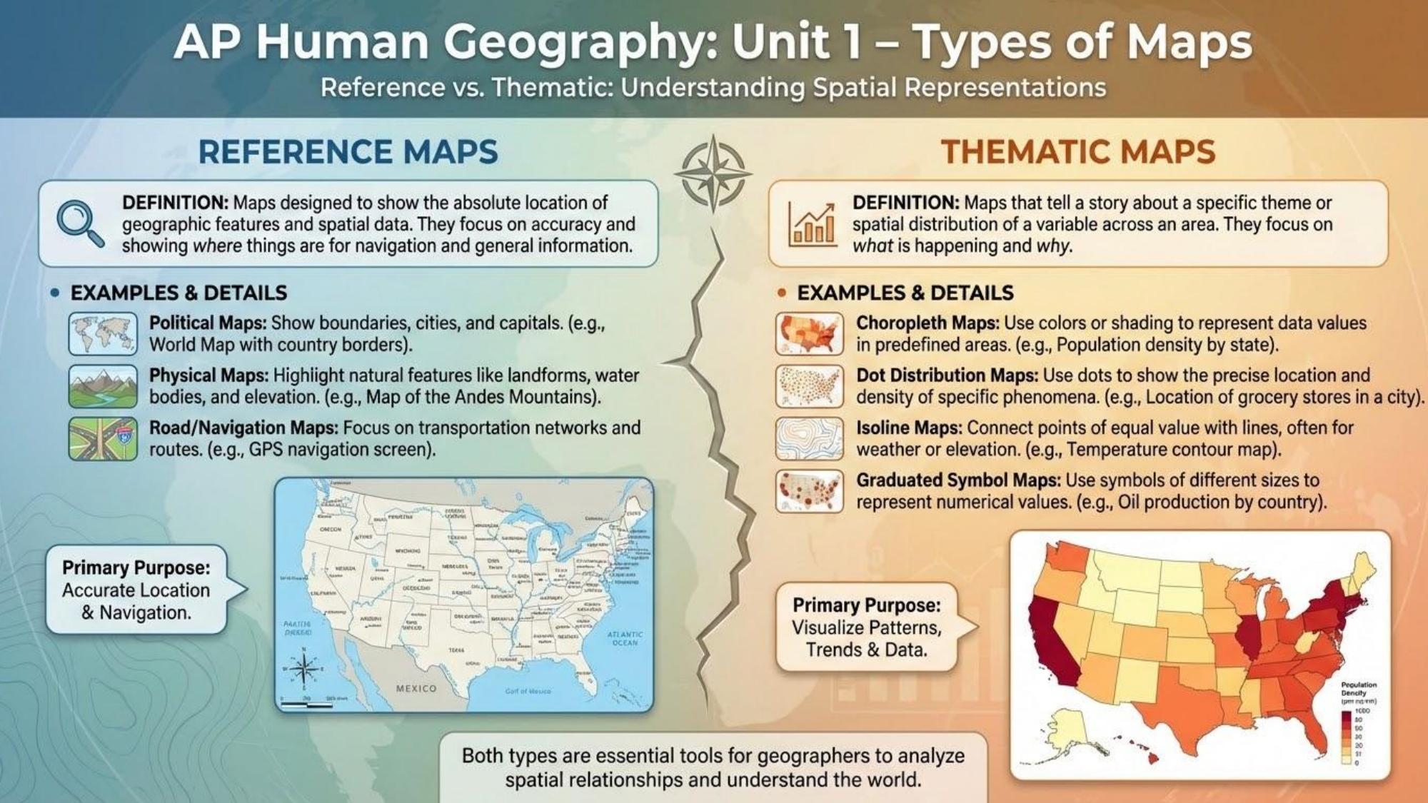
Maps are powerful tools — and powerful distortions
Every map projection distorts reality in some way (area, shape, distance, or direction). Understanding map types and their limitations is essential — a cartogram showing GDP looks nothing like a physical map, but both reveal important truths about the world.
Big Idea 3
Scale matters — what you see depends on where you look from
Geographic patterns look different at different scales. Urban poverty might not be visible at a national scale but is stark at the neighborhood level. Choosing the right scale of analysis is essential for geographic understanding.
Big Idea 4
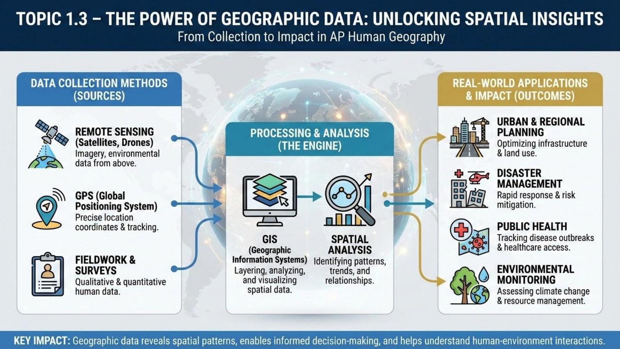
Geographic data and technology have transformed how we understand the world
GIS, remote sensing, and GPS have revolutionized geography, allowing analysis of massive spatial datasets. These tools power everything from disaster response to urban planning to election mapping.